
Duntiblae and Waterside
By Edward Z Smith, October 2021
In the 14th century, a mill was constructed at Duntiblae. Power to turn the mill wheel was obtained from the Luggie
Water, which flowed through the village. Various crops farmed by local farmers (including corn, barley, wheat, peas and malt) were ground there. Crop milling continued until a severe fire in 1850, which resulted in the closure of the mill. The site was then converted to manufacture high-quality spades and shovels, which continued until closure in the early 1930s.
Water, which flowed through the village. Various crops farmed by local farmers (including corn, barley, wheat, peas and malt) were ground there. Crop milling continued until a severe fire in 1850, which resulted in the closure of the mill. The site was then converted to manufacture high-quality spades and shovels, which continued until closure in the early 1930s.
A short distance upstream, the old mill, dam and lade were constructed in 1779 to process locally grown flax to produce linen for weaving, which, along with farming, was the main source of employment in the village. The lade from the flax mill extended downstream, supplying a controlled flow of water to the Duntiblae mill. The decline in demand for flax for the weaving Industry resulted in the flax mill being closed in the mid-1800s, with the building becoming a ruin by the early 20th century. The dam was breached with the use of explosives by persons unknown in the late 1940s (a disgruntled local angler, according to rumour, as the dam was preventing the trout moving upstream).
In 1795 James and Robert Jeffrey established a malt whisky distillery next to the Duntiblae mill. Whisky of the highest quality was produced at this site until the 1860s. Duntiblae House, built in the early 18th century, was well established as an overnight resting place or staging-post by cattle drovers heading for the Glasgow markets. In 1905 it became a fruit, vegetable and flower nursery as well as a family home, and it remained in the ownership of James Wilson until around 1952. For many years the building was used as a vehicle repair and body shop by Waterside villager Jim Hunter. The house, which is now derelict, is currently being assessed by his son William for possible renovation.
The Waterside Miners' Welfare Institute was constructed in the 1920s and served the village well. Its popularity led to the construction of The Waterside Miners Welfare and Social Club, which opened with much fanfare in 1964, when Kirkintilloch was still a ‘dry town’. Duntiblae for many years was a hub of community, social and entertainment activities serving Waterside and the Kirkintilloch area. Unfortunately a change in public interests and the Covid-19 pandemic resulted in the closure of the Waterside Miners, as it was known, in March 2020.
Over the past few centuries Duntiblae was a thriving and busy place, from weaving to bingo – what a mix! But a mystery still remained: the caves...
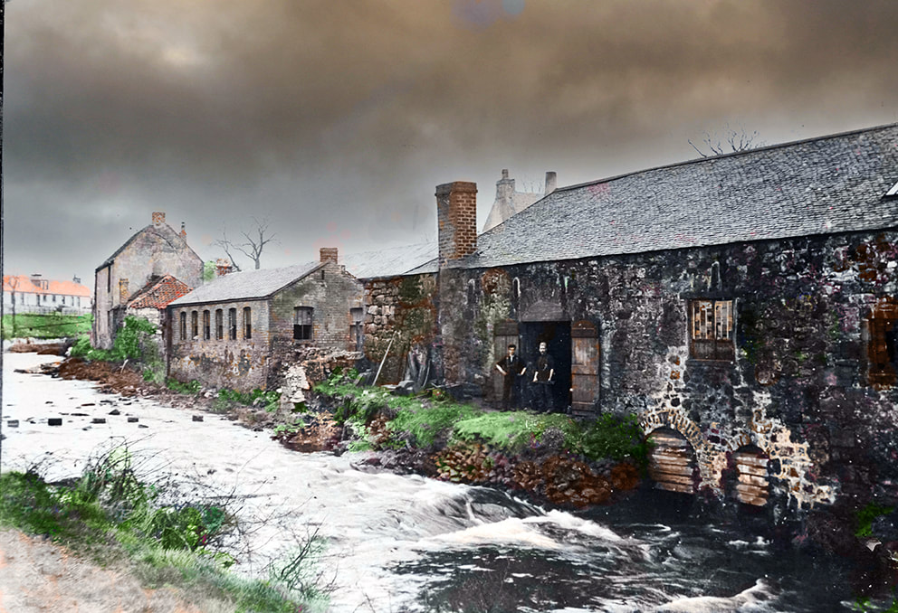
Spade forge, early 20th century (formerly the Duntiblae mill)

Ruins of the old flax mill and dam, late 19th century
Waterside, 1950s
Waterside and the Luggie in the 1950s was a very interesting and exciting place for us village children to grow up in. After school, or during the weekends or holidays, we were spoilt for choice, with lots of places to explore and play.
In addition to Luggie we had the ruins of the two mills with their dam and lade; the Gartshore estate, with its stables, dovecoat, dog kennels, bowling green, and walled garden where our parents would send us to purchase fruit or vegetables. Then there were the ruins of the recently closed Wallace’s Coal Mine, its still standing landmark bing, and the nearby Edinburgh to Glasgow main railway line; the stepping stones to cross the Luggie, Woodilee Hospital and its Home Farm, the unique and creepy Spiders Bridge crossing high above the Bothlin Burn, and an abundance of wildlife and flora.
In addition to Luggie we had the ruins of the two mills with their dam and lade; the Gartshore estate, with its stables, dovecoat, dog kennels, bowling green, and walled garden where our parents would send us to purchase fruit or vegetables. Then there were the ruins of the recently closed Wallace’s Coal Mine, its still standing landmark bing, and the nearby Edinburgh to Glasgow main railway line; the stepping stones to cross the Luggie, Woodilee Hospital and its Home Farm, the unique and creepy Spiders Bridge crossing high above the Bothlin Burn, and an abundance of wildlife and flora.
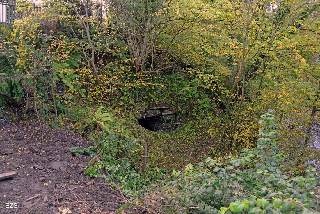
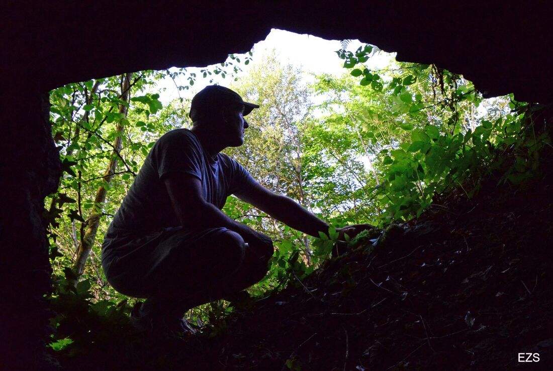
We often played near the caves on the Luggie embankment at Duntiblae but were very wary of them. There were three caves, the largest being about two metres in diameter and extending a few metres into the embankment. The other two were located slightly below the larger one and were too narrow to gain access. We never found out how or when they came to be, or what purpose the caves served. It was a mystery and remained so until very recently.
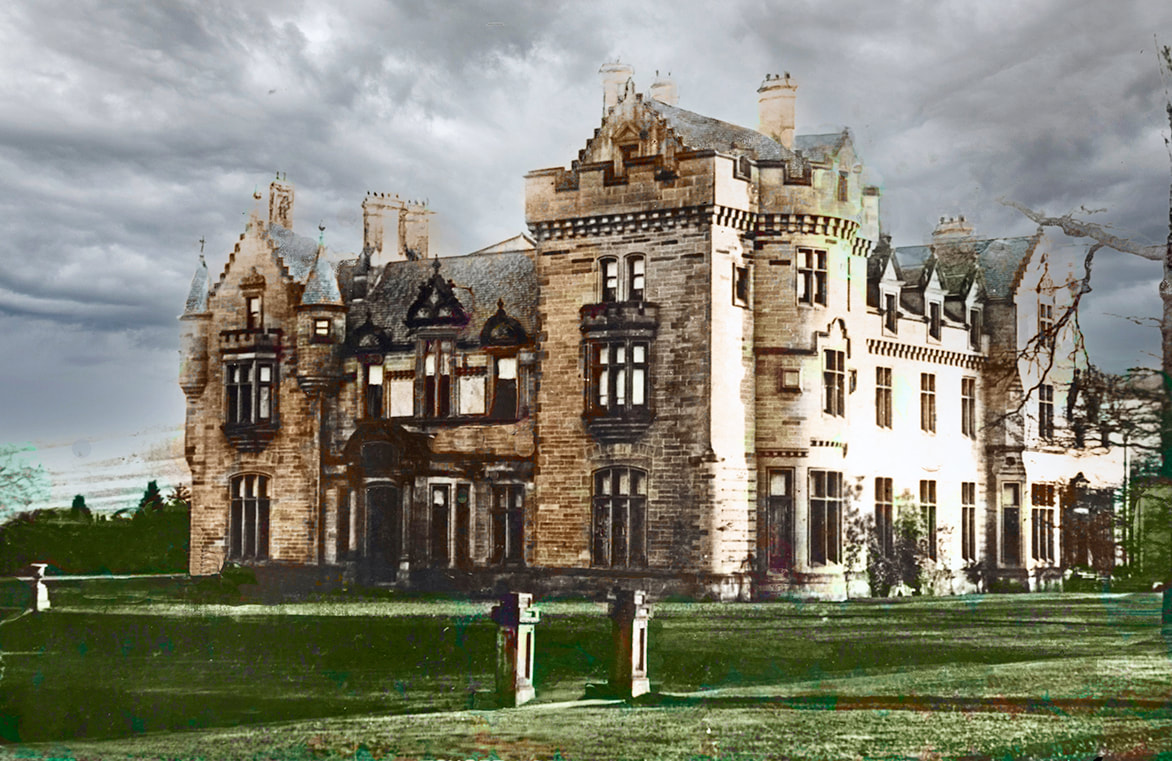
Gartshore House (the 'Big Hoose'), home of William Whitelaw (1st Viscount Whitelaw), demolished in the early 1960s
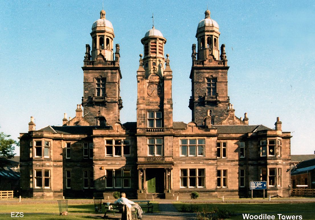
Woodilee centre, recreation hall, and pepper pot towers
Coal mining in Scotland: the early years
The mining of coal in Scotland was first recorded by monks in East Lothian in the early 13th century. Most of the coal workings were in the east of Scotland around the Forth estuary.
The methods to retrieve the coal advanced very slowly. At first coal was picked or quarried wherever seams cropped above the earth (outcrops). An alternative method was by digging holes or shallow tunnels into hillsides or embankments. Pick and shovel being the order of the day, both methods were used to extract the coal on a very small scale.
By the 18th century, various larger-scale methods of extracting the coal had been developed. One of the most common methods was the introduction of drift mines. This type of mine was basically a narrow tunnel dug by hand into an embankment at an upward angle towards and through the seam. The coal was extracted as the tunnel was driven forward and through the seam. Commonly called in Scotland 'ingaunees' (ingoing eyes), drift mines were very dangerous places to work, with tunnel collapses, flooding and gas explosions occurring frequently.
The biggest improvement in the mining methods was the introduction of the pit and level system: a narrow drainage tunnel was driven below the coal seam, allowing water to drain by gravitation. These tunnels also provided an additional source of much-needed fresh air to the mine workers. This allowed the coal to be worked at depths of up to 30 metres.
Around the mid-18th century, a small drift/pit and adit mine was established at Duntiblae to extract limestone and coal. With water from its drainage tunnel draining into the Luggie Water, this drift mine produced coal and limestone from around 1750 to the mid-19th century.
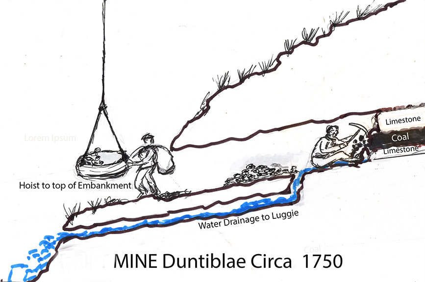
Impression of drift or ingaunee mine circa 1750-1800
Ground survey: the Duntiblae caves mystery unfolds
As Kirkintilloch expands towards Waterside, the site and lands of the Woodilee are being developed into a huge housing estate. The Woodilee Village has replaced the former hospital and grounds; the Home Farm’s meadows and crop fields are disappearing at breakneck speed. The next phase of the Woodilee Village development will be the construction of houses on the fields between Fauldhead and Duntiblae.
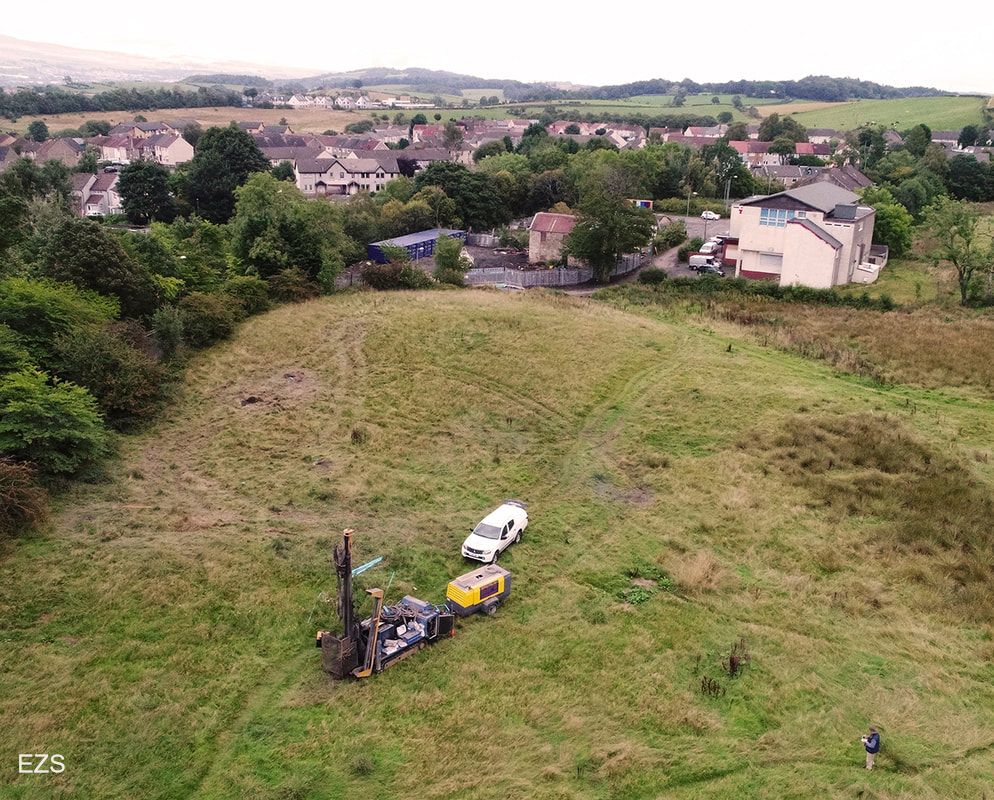
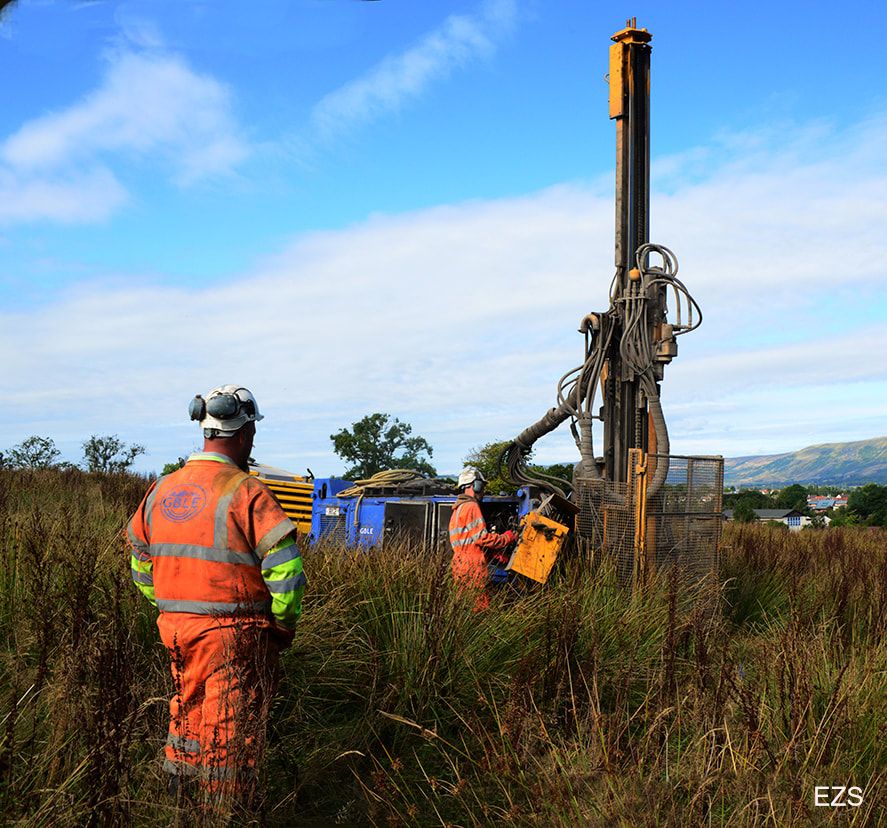
Ground surveys recently undertaken confirmed the existence of very old mine workings beneath the Duntiblae meadow. The findings also confirm the suggestions by some of the Waterside villagers that the caves on the Luggie embankment were the entrances and exits to a very old mine, of which little detail is on record.
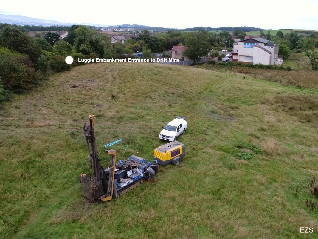
A top hammer water percussion rig was used to drill under the field, and the probing confirmed the existence of a limestone and coal outcrop just beneath the surface of the field. The existence of disused mine tunnels beneath the surface of the field was also confirmed. As the percussion rod and drill made contact with the limestone and coal seams, the depth of each was recorded and the exhaust vapours visually assessed. White exhaust vapour signified the depth and thickness of the limestone, and black vapour exhaust identified the existence of the coal.
The technicians also confirmed that access and exit of miners, coal, limestone, waste and drainage water was by means of the three caves situated on the Luggie embankment. (CAVE MYSTERY SOLVED). Miners, minerals and waste were hoisted to the top of the embankment, the water draining down the embankment from the drainage ditches to the Luggie below.
The tunnel entrance to an ingaunee or drift mine was known as an adit.
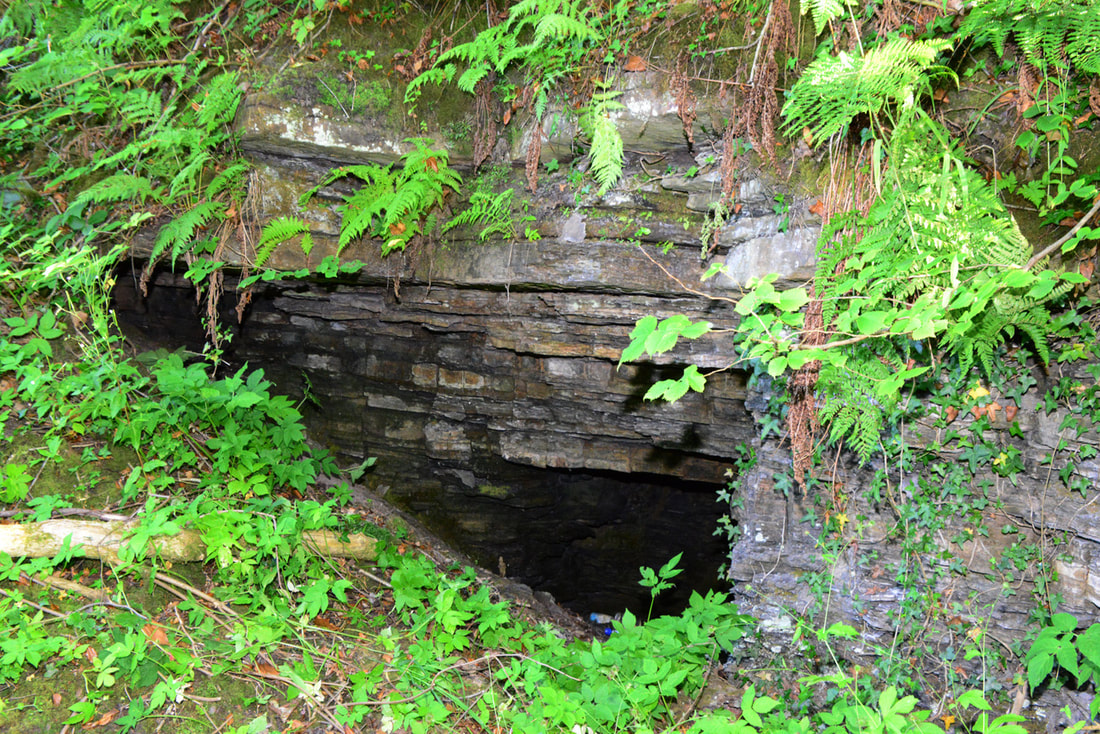
Partly exposed and backfilled mine entrance/exit (adit), July 2021
When mining operations ceased and the mine closed, the larger tunnel was backfilled, leaving what for many years were thought to be very shallow caves on the embankment.
The probing and analysis confirmed the layers of strata and the depth and thickness of the seams of limestone and coal.
|
Layers
Earth Sandstone Limestone Coal Limestone Sandstone |
Depth of contact (approx.)
n/a n/a 6m- 6m 6m+ n/a |
Seam thickness
n/a n/a 500mm 300mm 200mm n/a |
The survey also confirmed that the tunnels and mine workings were mainly collapsed and flooded. Some waste water can be seen at times draining into the nearby Luggie. The existence of these tunnels and old workings does not present a problem nowadays: it is common practice in the construction industry to either fill and stabilize old, shallow abandoned mine workings with grouting mixture or to excavate down and remove any tunnels and workings.
Top hammer water percussion site investigation, September 2021
|
|
|
Entrance or adit to Duntiblae drift mine, July 2021
|
At the exit to Duntiblae drift mine, July 2021
|
|
Top hammer water percussion drilling, Duntiblae
|
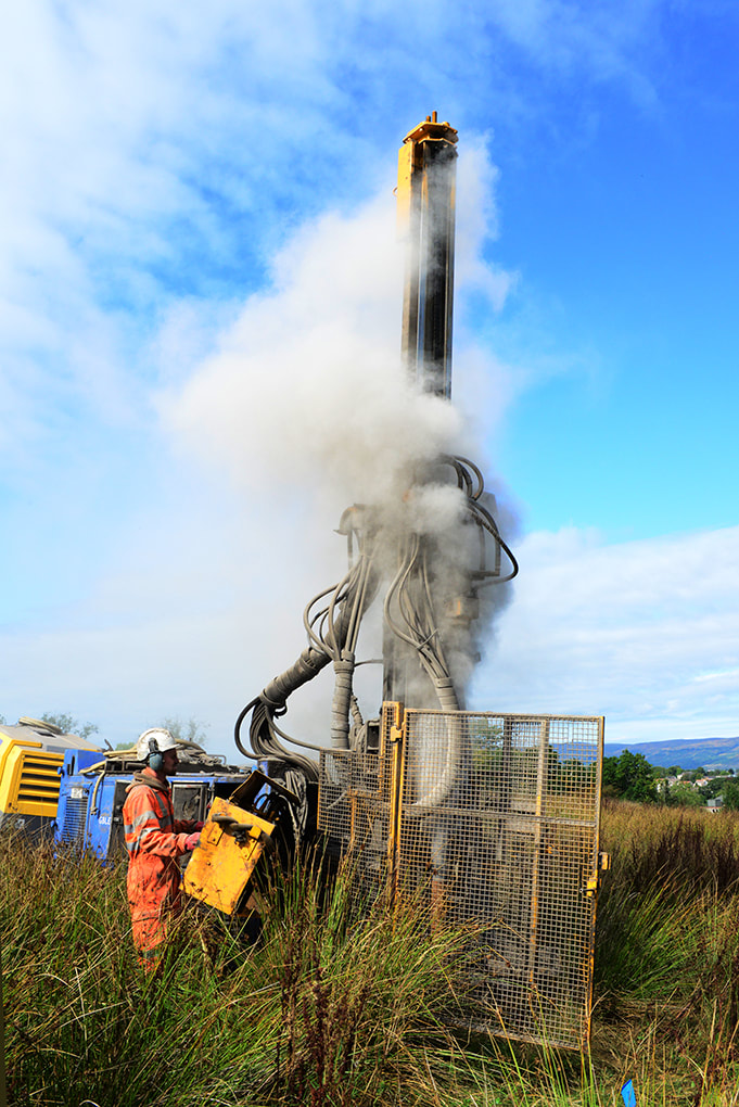
Limestone (white exhaust vapour)
|
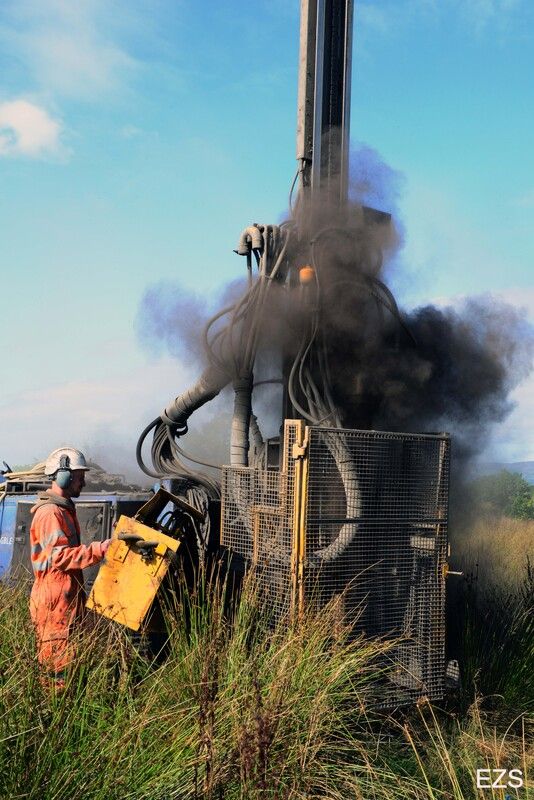
Coal (black exhaust vapour)
|
Ground survey, Dam Braes
A similar survey was undertaken in the field located between the east section of the Dam Braes and Chryston Road. The probing identified a limestone seam and a coal seam 3.5m and 12.5m respectively beneath the surface of the field. The adit was thought to be located in the nearby Luggie embankment but could not be found as over the years very large trees and thick undergrowth have covered the area.
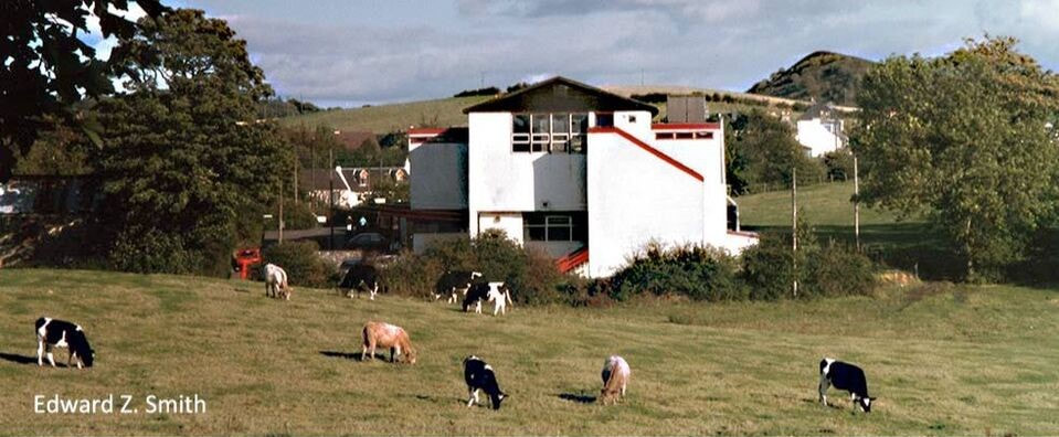
Former Miners' Welfare and Social Club, with Wallace's (Wester Gartshore) Pit Bing in the background:
a historic view soon to be lost
a historic view soon to be lost
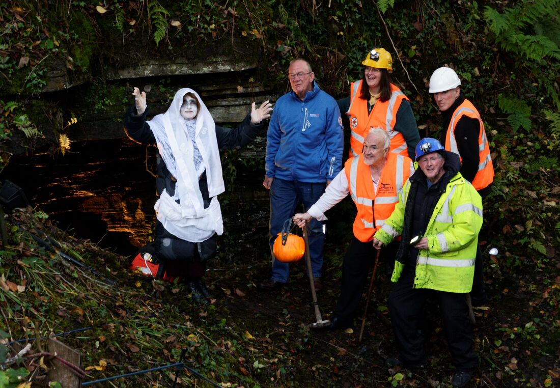
Duntiblae ghost
As mentioned on another page, local rumours over the years mentioned ghostly voices emanating from below the Duntiblae meadow. I would never have envisaged that nearly 70 years on I would lead a team in search of the possible ghost.
But there she is, a happy Duntiblae ghost, free at last after 200 years, maybe!
But there she is, a happy Duntiblae ghost, free at last after 200 years, maybe!
